|
Freezing and Trailing...or an amazing tale of hardship, frustration and other stupid reasons... |
|
Right, so this page is about a thing called the "Friesland Trail" (or Fryslân Trail according to the guy
who makes the badges...).
A scouting thing, where you walk about 10 hours (this year (2003) our team started at
5.20pm), trying to solve difficult puzzles which you need to
understand to know where you have to go, using obscure objects to tell
you the route, following bleeping or reflective things through dense
woodland, all this trying to avoid getting wet at places where the
organization constructed weird and wonderful devices to cross rivers
and canals and attempting to keep your feet dry during routes that
cross swamps, moors and flooded paths. All the while hoping the
weather doesn't turn for the worst, that nobody breaks anything and
that the teams who finish the trail earlier than yours don't drink all the beer...
Organized every year by a group of people from the scouting region Friesland for about 150 idiots of the
northern provinces willing to take part in it, this Trail-team, as they are known, sadistic by nature,
have chosen the second weekend of chilly december for their yearly quest.
So why take part? Actually... somehow it's quite good... Go nice places, meet new and interesting
people, oh, and not getting shot.
And of course, most important of all, to be able to reply to people numbingly asking you
what you did this weekend: Oh, I tracked reflective silver painted treeleaves with animals
painted on them through dense woodland at 1 in the morning, with a flashlight and a backpack
filled with dry clothes. The looks you get just cheer up an entire day.
Right, that clears things up, you must now know being a Friesland Trailer is cool and very
sensible.
WHAT!? Still not convinced?? You strange thing! *sighs* Let me see how I can make the
obvious more obvious.
Aah, lets start off with some photos taken of the Trail of 2002. These nice photos were taken by Yours Truly (well, mostly anyway). Okay, 2002 might not completely be the best example, I wonder... Let me explain. In 2002 our team was the quickest of all teams walking that year's Trail... yes! SHOCK HORROR!! Anyway, herefor the pictures are mostly of people getting drunk afterwards, which is of course also an important part of any Friesland Trail.
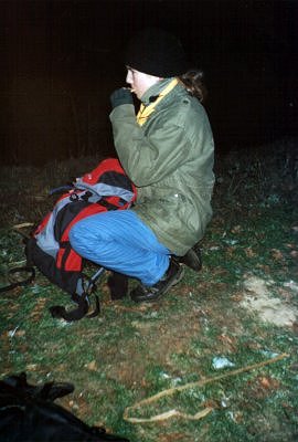 Femke having a quick snack to stay sharp and vitalized. |
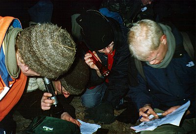 Several of my teammembers, including Aglamian Dirk, trying to work out route 12. |
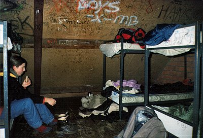 Femke taking of her walkingboots at the youth-hostel (for the lack of a better word for it) where the Trail concluded this time. |
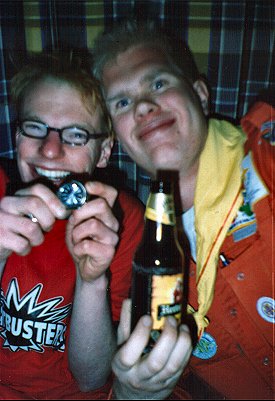 Gerlof en Dirk showing in weeting amazement how fucking fast we were this year. |
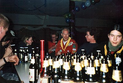
 While zillions of groups are still lost out there in the (literal) freezing cold, inside it's getting so warm, that camera has some trouble acclimatizing... |
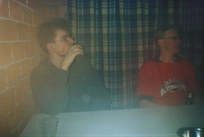
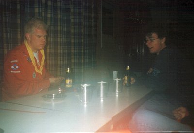 Lightened by slacky candle-holders, still a little stunned by our achievement Dirk and Rene start on their first beer. |
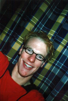 Gerlof, as always, his very happy self. |
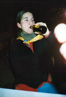 In the meantime, Femke slaughters herself another beer. |
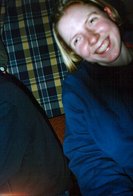 Boukje of Scouting the Brimzen from Buitenpost. |
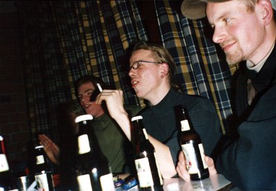 Three members of the other team from my scoutinggroup, trying to think up excuses to account for their humiliating defeat. |
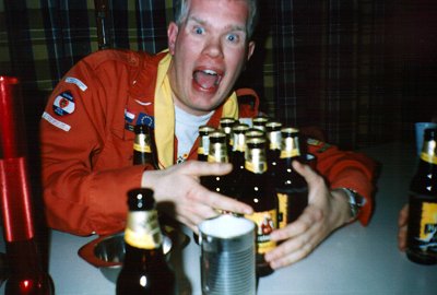 Dirk: "BEER!! BEER!!! GIVE ME MORE BEER!!! MINE!! MUWAHAHAHA!!!" |
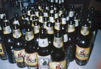 Even more beer, glorious beer... this is starting to fabricated a rather wrong image of Scouting, isn't it? |
 I tell you! We are all very responsible people! Just look at us! Scouting rulez! *gets up and leaves to get another beer from the fridge* |
Secondly, in my quest to convince the world of the joyfulness of Trailing, I present to you a selection. A selection of puzzles, ie routes, from the route-booklets of 2002 and 2003. It's just a small selection, because most of the puzzles appearing in the booklets require external objects, ranging from maps to wooden dragonheads, of which scanning is rather problematic, due to the lack of my possession of them. And some routes just require you to track lights, reflectors or beepers, which are even harder to scan, since they belong to the Trail-team. It would be too much to explain the routes in fullness to you, but their appearance here, should at least give a feeling, of what kind of stuff we have to put up with.
|
 I don't exactly remember what the point of this puzzle was exactly. I don't think I even knew when we had to figure it out. It goes something along the lines of this (an example): You start on the front wheel, at the top, you go anti-clockwise, counting the distance along the circumference to the first spoke. This number (after some fiddling with some information mentioned) gives you a number of steps. At this first spoke there goes a line inwards from the outside of the wheel, with a 30 next to it. Again, with some information mentioned before, you can now figure out that your direction is 150 + 30 = 180 degrees. Thus now, use your compass and walk the number of steps in the direction of the bearing calculated. Repeat process, now starting from the first spoke. (this is one of the hardest puzzles I have ever done on any hike) |
 This is basically something we call a 'strippenkaart'. It is too much to explain to you now how a stippenkaart works, but if you ever want to know, let me know (you never now when I am in some weird mood, feeling like making a new insane webpage). It basically is a twisted map, on which the road you want to follow is now a straight line, starting from below going upwards. (they usually get way more systematic than this one, with just a straight horizontal line, with some vertical lines on the left and right) |
|
 I don't remember the exact point of this puzzle, but it involves looking up the coordinates on the grid. Each coordinate (eg 2340 - 5725) stands for a crossing, where you have to look up that coordinate and then conclude from the picture which path you need to take. (I think it had something to do with which way the figures in the picture were looking (or it was something completely different, like something with lines). |
|
|
 Opposed to what the big map on this page seems to suggest, it has no use what so ever (not that I ever figured out anyway). The route is quite simple, as you might have figured from the lines through the first column of numbers. It's a compass route, where the numbers stand for a number (1 to 9), a compass bearing and the number of steps. For example, 2.30.42 stands for the second bearing, 30 degrees and 42 steps to the next bearing. |
 And for last a compass route that seems at first rather impossible (only the symbol for 0 is given, 1 and 2 were filled in by me during the route). It's here that the landscape comes to the rescue. All the symbols stand for a digit. The route started on a path going from about northeast (45 degrees) to about southwest (225 degrees). Keeping in mind that the first bearing has to have three digits, a more accurate bearing of the path gives us 220 degrees for the first number. Two crossing further on, in same fashion the symbol for 1 was worked out, and after that (with the exception of no 5) the rest was easy cruising. My favourite route for 2003. |
|
And so we come to the end of this ramble. My creativity has run dry, but by now you must
have been converted. My powers are omnipious, or something like that. Walking a Friesland
Trail may have seemed weird, stupid, insane, nonsense and horribly out of your mind at first, but
now you know better. Friesland Trails are very cool. Repeat after me now: "Friesland Trails are
cool. Friesland Trails are cool. Friesland Trails are very cool. I will overthrow Reinder for you
and set you, Pixel, upon the Aglami throne. Friesland Trails are cool. Friesland Trails are very cool."
Thank you. Goodnight. You have been a great audience. *bows*